
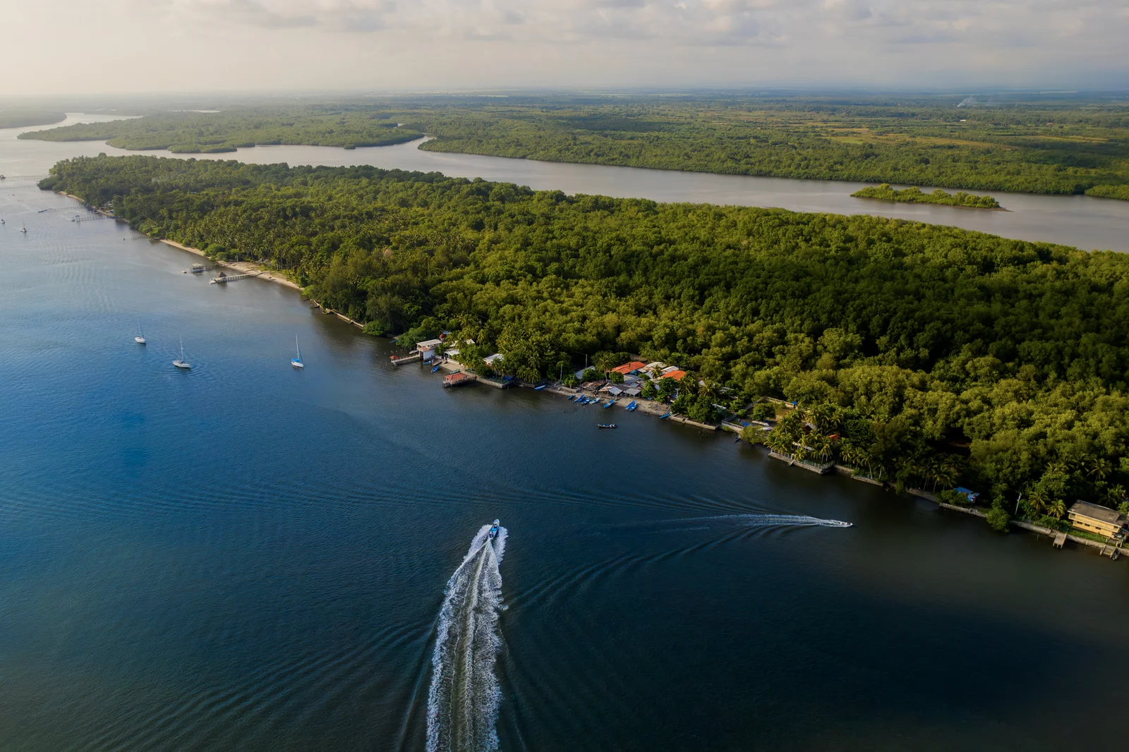
Jaltepeque Estuary
28 kilometers of channels through mangroves, with over 120 species of birds and inhabited islands.
About Jaltepeque Estuary
Estuary of brackish water between the departments of La Paz and San Vicente, featuring approximately 28 kilometers of channels surrounded by mangroves. It can be explored by boat, kayak, or paddleboard, and is one of the best places in the country for birdwatching: over 120 species have been recorded. Within the estuary lies Tasajera Island, covering about 3 square kilometers, situated between the mouth of the Lempa River and the El Cordoncillo inlet.
Details
Hours
Mon-Sun 9:00 AM-5:00 PM
Best time to visit
Dawn, which is when there is the most bird activity.
Highlight
Ramsar Site
Brief History
The Jaltepeque complex was declared a Ramsar site on February 2, 2011, becoming the sixth wetland of international importance recognized in El Salvador. It is the second largest area of brackish wetlands and intertidal forest in the country, after the Jiquilisco Bay. It brings together several ecosystems within the same territory: mangrove forests, sandy beaches, freshwater lagoons, and seasonal and permanent rivers. On Tasajera Island, cashew is cultivated, the fruit of which is part of the diet of the yellow-naped parrot, one of the protected species in the area.
Photo Gallery
Location & Map
Visit Tips
I left at dawn: it's when you see the most birds in the channels.
You can explore by boat, kayak, or paddleboard, depending on how much you want to paddle.
Bring binoculars and insect repellent: it's a mangrove, there are mosquitoes.
Want to visit Jaltepeque Estuary?
Tours, local guides, private transport and car rental. Tell us what you need and we'll arrange it for you.

TuChero · AI guide
Artificial Intelligence specialized in El Salvador
Want to discover more places?
Ask TuChero, your AI travel guide, for the best places, tips and recommendations for traveling around El Salvador.